File:Old Broad Street, City of London (C) Stephen McKay - Geograph - 582012.jpg

From Roader's Digest: The SABRE Wiki
Jump to navigation Jump to search

Old_Broad_Street,_City_of_London_(C)_Stephen_McKay_-_Geograph_-_582012.jpg(639 × 480 pixels, file size: 135 KB, MIME type: image/jpeg)

Y topleft.gifY topright.gif
Description:
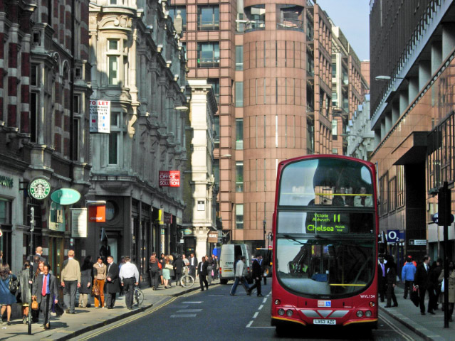
Old Broad Street, City of London (C) Stephen McKay
This is the northern part of Old Broad Street leading up to Liverpool Street station. The no. 11, taking in St Pauls, The Strand and Whitehall is, perhaps, London's best known bus route.
Location:51.516837, -0.083002
Road:B130
Date:11 10 2007
Photographer:Stephen McKay and licensed for reuse under this Creative Commons Licence
Source:Geograph

Map

Y btmleft.gifY btmright.gif

Galleries  | B130 | unclassified | The City

File history

Click on a date/time to view the file as it appeared at that time.

Date/TimeThumbnailDimensionsUserComment
current20:02, 7 December 2014Thumbnail for version as of 20:02, 7 December 2014639 × 480 (135 KB)Vlad (talk | contribs)'''Old Broad Street, City of London (C) Stephen McKay '''<br/>This is the northern part of Old Broad Street leading up to Liverpool Street station. The no. 11, taking in St Pauls, The Strand and Whitehall is, perhaps, London's best known bus route.

The following 2 pages use this file:

Metadata

SABRE - The Society for All British and Irish Road Enthusiasts
Discuss - Digest - Discover - Help