File:Old road sign on the B6160, Kettlewell - Geograph - 1346871.jpg
Jump to navigation
Jump to search

No higher resolution available.
Old_road_sign_on_the_B6160,_Kettlewell_-_Geograph_-_1346871.jpg (640 × 471 pixels, file size: 124 KB, MIME type: image/jpeg)
| |||||||||||||||||||||||||
|
Galleries | B6160 | Speed limit sign/30 mph | Pre-Worboys Direction Signs | S2 | ||
File history
Click on a date/time to view the file as it appeared at that time.
| Date/Time | Thumbnail | Dimensions | User | Comment | |
|---|---|---|---|---|---|
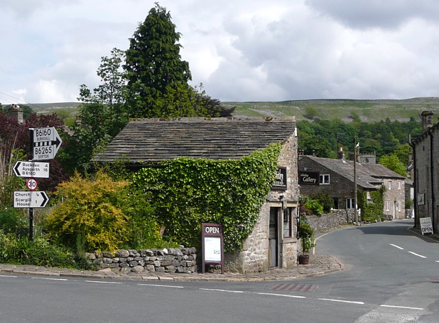
| current | 18:39, 2 April 2010 | | 640 × 471 (124 KB) | Bob@romiley1 (talk | contribs) | '''Old road sign on the B6160, Kettlewell'''<br/>The chequers over 'B6165' indicates that the latter road branches off ahead, to Skipton. |
File usage
The following page uses this file: