File:Original A74 alignment, south of Ecclefchan - Coppermine - 18478.JPG
Jump to navigation
Jump to search

Size of this preview: 800 × 600 pixels. Other resolution: 1,136 × 852 pixels.
Original file (1,136 × 852 pixels, file size: 88 KB, MIME type: image/jpeg)
| ||||||||||||||
|
Galleries | A74 | Abandoned Road | ||
File history
Click on a date/time to view the file as it appeared at that time.
| Date/Time | Thumbnail | Dimensions | User | Comment | |
|---|---|---|---|---|---|
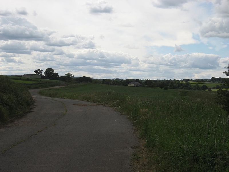
| current | 17:10, 30 March 2010 | | 1,136 × 852 (88 KB) | Rileyrob (talk | contribs) | '''Original A74 alignment, south of Ecclefchan''' This old curve cuts through a field, about 3 miles south of Ecclefechan <small>''Originally uploaded to Coppermine on Jun 15, 2008 by leopard680''</small> |
File usage
There are no pages that use this file.