File:Osidge Lane (C) Martin Addison - Geograph - 1298075.jpg

From Roader's Digest: The SABRE Wiki
Jump to navigation Jump to search

Osidge_Lane_(C)_Martin_Addison_-_Geograph_-_1298075.jpg(640 × 427 pixels, file size: 160 KB, MIME type: image/jpeg)

Y topleft.gifY topright.gif
Description:
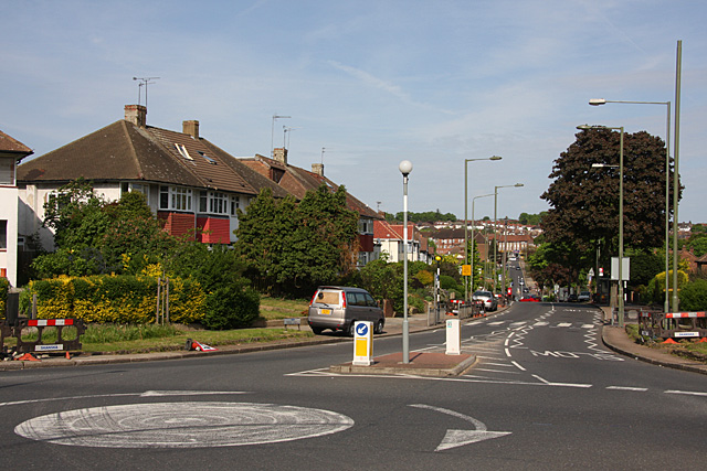
Osidge Lane (C) Martin Addison
The B1453, seen from the junction with Brunswick Park Road. The road drops down into the valley of Pymme's Brook before climbing to connect with the A111, Chase Side, on the horizon.
Location:51.630757, -0.149294
Road:B1453
Date:10 05 2009
Photographer:Martin Addison and licensed for reuse under this Creative Commons Licence
Source:Geograph

Map

Y btmleft.gifY btmright.gif

Galleries  | B1453

File history

Click on a date/time to view the file as it appeared at that time.

Date/TimeThumbnailDimensionsUserComment
current22:15, 7 November 2013Thumbnail for version as of 22:15, 7 November 2013640 × 427 (160 KB)Vlad (talk | contribs)'''Osidge Lane (C) Martin Addison '''<br/>The B1453, seen from the junction with Brunswick Park Road. The road drops down into the valley of Pymme's Brook before climbing to connect with the A111, Chase Side, on the horizon.

The following 2 pages use this file:

Metadata

SABRE - The Society for All British and Irish Road Enthusiasts
Discuss - Digest - Discover - Help