File:Oxford Ring Road Plan 1958.jpg
Jump to navigation
Jump to search

Size of this preview: 437 × 599 pixels. Other resolution: 500 × 685 pixels.
Original file (500 × 685 pixels, file size: 66 KB, MIME type: image/jpeg)
| |||||||||||||||||||||||||
|
Galleries | A34 | A40 | A4142 | Oxford Ring Road | ||
File history
Click on a date/time to view the file as it appeared at that time.
| Date/Time | Thumbnail | Dimensions | User | Comment | |
|---|---|---|---|---|---|
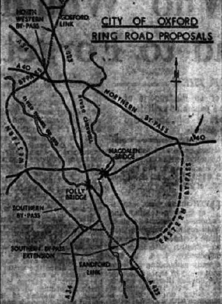
| current | 19:43, 21 July 2020 | | 500 × 685 (66 KB) | Ross spur (talk | contribs) | A plan of the Oxford Ring Road from 1958. The planned sections are shown as dashed lines. |
File usage
The following 2 pages use this file: