File:Parting of the ways at the northern end of the A42 - Geograph - 2335366.jpg

From Roader's Digest: The SABRE Wiki
Jump to navigation Jump to search

Parting_of_the_ways_at_the_northern_end_of_the_A42_-_Geograph_-_2335366.jpg(640 × 480 pixels, file size: 61 KB, MIME type: image/jpeg)

Y topleft.gifY topright.gif
Description:
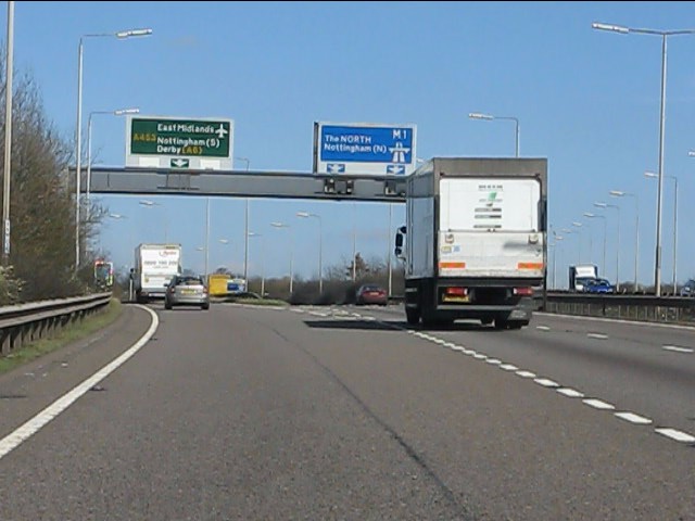
Parting of the ways at the northern end of the A42 The A42 flows seamlessly into the M1 at the latter's junction 23a, with a slip road taking non-motorway traffic on a parallel route north toward the East Midlands' cities.
Location:52.815302, -1.307800
Road:A42
Date:24 03 2011
Photographer:(c) Copyright Peter Whatley and licensed for reuse under this Creative Commons Licence
Source:Geograph

Map

Y btmleft.gifY btmright.gif

Galleries  | A42 | Finger Farm Roundabout

File history

Click on a date/time to view the file as it appeared at that time.

Date/TimeThumbnailDimensionsUserComment
current13:37, 8 June 2016Thumbnail for version as of 13:37, 8 June 2016640 × 480 (61 KB)Jeni (talk | contribs)'''Parting of the ways at the northern end of the A42''' The A42 flows seamlessly into the M1 at the latter's junction 23a, with a slip road taking non-motorway traffic on a parallel route north toward the East Midlands' cities.

The following 3 pages use this file:

Metadata

SABRE - The Society for All British and Irish Road Enthusiasts
Discuss - Digest - Discover - Help