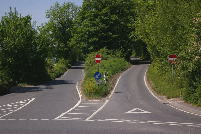
Pilgrims Way near Burham One of the quirks of the UK road system: an unclassified dual carriageway outside urban areas is unusual in itself, but what makes this half mile long dual carriageway extra special is that it is built with a single lane for each carriageway. Officially, it has a 70 mph speed limit, but its narrowness, bends and profile would make achieving this a challenge. This is the eastern end - for the western end, see 799349.
'''Pilgrims Way near Burham''' One of the quirks of the UK road system: an unclassified dual carriageway outside urban areas is unusual in itself, but what makes this half mile long dual carriageway extra special is that it is built with a single lane for each carriageway. Officially, it has a 70 mph speed limit, but its narrowness, bends and profile would make achieving this a challenge. This is the eastern end - for the western end, see 799349.
