File:Pont Dafydd - Geograph - 1736745.jpg

From Roader's Digest: The SABRE Wiki
Jump to navigation Jump to search

Pont_Dafydd_-_Geograph_-_1736745.jpg(640 × 480 pixels, file size: 122 KB, MIME type: image/jpeg)

Y topleft.gifY topright.gif
Description:
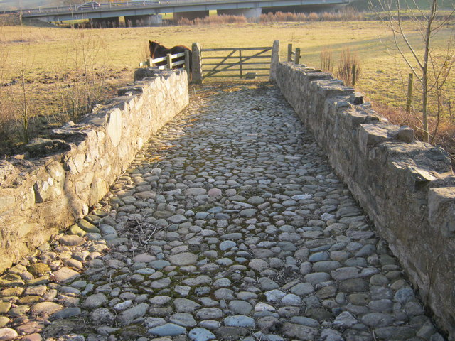
Pont Dafydd
This is an ancient road bridge over the River Clwyd. In its earlier days it had no side walls, so it must have been a dangerous crossing for horses pulling a coach. The river has now been diverted and so the bridge is over dry land.
Location:53.263798, -3.435030
Road:
Date:04 03 2010
Photographer:� Copyright David and Rachel Landin and licensed for reuse under this Creative Commons Licence
Source:Geograph

Map

Y btmleft.gifY btmright.gif

Galleries  | Pont Dafydd

File history

Click on a date/time to view the file as it appeared at that time.

Date/TimeThumbnailDimensionsUserComment
current20:04, 1 September 2010Thumbnail for version as of 20:04, 1 September 2010640 × 480 (122 KB)Kieron (talk | contribs)'''Pont Dafydd'''<br/>This is an ancient road bridge over the River Clwyd. In its earlier days it had no side walls, so it must have been a dangerous crossing for horses pulling a coach. The river has now been diverted and so the bridge is over dry land.

The following page uses this file:

Metadata

SABRE - The Society for All British and Irish Road Enthusiasts
Discuss - Digest - Discover - Help