File:Poole Bridge - Geograph - 1759548.jpg

From Roader's Digest: The SABRE Wiki
Jump to navigation Jump to search

Poole_Bridge_-_Geograph_-_1759548.jpg(640 × 429 pixels, file size: 63 KB, MIME type: image/jpeg)

Y topleft.gifY topright.gif
Description:
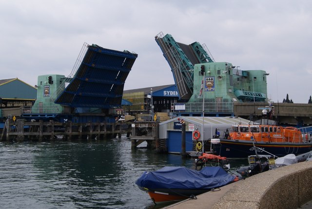
Poole Bridge
Poole Lifting Bridge in Poole, Dorset, constructed in 1927. Situated on the western end of Poole Quay, the bridge provides a road link as part of the A350 road across a busy shipping channel between Poole's town centre and the suburb of Hamworthy.
Location:50.712332, -1.992583
Road:A350
Date:11 03 2010
Photographer:� Copyright Peter Elsdon and licensed for reuse under this Creative Commons Licence
Source:Geograph

Map

Y btmleft.gifY btmright.gif

Galleries  | A350

File history

Click on a date/time to view the file as it appeared at that time.

Date/TimeThumbnailDimensionsUserComment
current19:21, 15 May 2010Thumbnail for version as of 19:21, 15 May 2010640 × 429 (63 KB)Bob@romiley1 (talk | contribs)'''Poole Bridge'''<br/>Poole Lifting Bridge in Poole, Dorset, constructed in 1927. Situated on the western end of Poole Quay, the bridge provides a road link as part of the A350 road across a busy shipping channel between Poole's town centre and the subur

The following page uses this file:

Metadata

SABRE - The Society for All British and Irish Road Enthusiasts
Discuss - Digest - Discover - Help