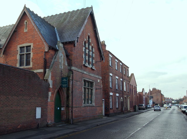
Portland Street-Victoria Street, Newark,... (C) David Hallam-Jones Currently called 'The Chapel', this building originally housed the 'Christ Church Parochial Rooms'. The premises were constructed in 1885 for bible classes, women's meetings, meetings for members of the Church of England's Temperance Society and for the distribution of soup to the poor 'with up to 1,000 gallons of soup being distributed per year'. Most recently, it has been a Business Centre. By the time the B6166 (leading to Farndon) has reached here, Portland Street - behind the photographer - has become Victoria Street
'''Portland Street-Victoria Street, Newark,... (C) David Hallam-Jones '''<br/>Currently called "The Chapel", this building originally housed the "Christ Church Parochial Rooms". The premises were constructed in 1885 for bible classes, women's meetings,...

_David_Hallam-Jones_-_Geograph_-_4337803.jpg&oldid=486531)