File:Potential route for A27 - Geograph - 724061.jpg
Jump to navigation
Jump to search

No higher resolution available.
Potential_route_for_A27_-_Geograph_-_724061.jpg (640 × 480 pixels, file size: 65 KB, MIME type: image/jpeg)
| |||||||||||||||||||||||||
|
Galleries | A27 | Crossbush Interchange | ||
File history
Click on a date/time to view the file as it appeared at that time.
| Date/Time | Thumbnail | Dimensions | User | Comment | |
|---|---|---|---|---|---|
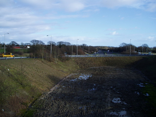
| current | 18:24, 2 August 2010 | | 640 × 480 (65 KB) | Johnny (talk | contribs) | '''Potential route for A27'''<br/>At present traffic travelling south on the A284 to Littlehampton uses this embankment. Work on the A27(T)stopped years ago due to lack of funding.<br /> <span class="nowrap"><a title="http://www.publications.parliament.u |
File usage
The following 2 pages use this file: