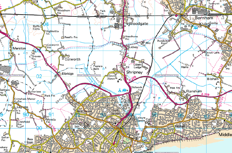
The proposed route of the Bognor Regis Northern Relief Road, from Berstead to Felpham. Show construction in two halves, meeting in a multiplex through the A29.
Originally uploaded to Coppermine on Aug 16, 2008 by mrvixen
This page includes a scan of a non-free copyrighted map, and the copyright for it is most likely held by the company or person that produced the map. It is believed that the use of a limited number of web-resolution scans qualifies as fair use under United States copyright law, where this web page is hosted, as such display does not significantly impede the right of the copyright holder to sell the copyrighted material, is not being used to generate profit in this context, and presents information that cannot be exhibited otherwise. If the copyright holder considers this is an infringement of their rights, please contact the Site Management Team to discuss further steps.
'''Proposed A259 Bognor Relief Road'''
The proposed route of the Bognor Regis Northern Relief Road, from Berstead to Felpham. Show construction in two halves, meeting in a multiplex through the A29.
<small>''Originally uploaded to Coppermine on Aug 1...
