File:Puckeridge- The Crown & Falcon public house - Geograph - 621050.jpg
Jump to navigation
Jump to search

No higher resolution available.
Puckeridge-_The_Crown_&_Falcon_public_house_-_Geograph_-_621050.jpg (640 × 480 pixels, file size: 67 KB, MIME type: image/jpeg)
| |||||||||||||||||||||||||
|
Galleries | C37 (Hertfordshire) | C36 (Hertfordshire) | Fordham's Corner | Puckeridge | Pictures from Geograph | ||
File history
Click on a date/time to view the file as it appeared at that time.
| Date/Time | Thumbnail | Dimensions | User | Comment | |
|---|---|---|---|---|---|
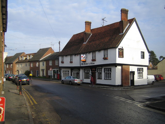
| current | 22:18, 8 April 2021 | | 640 × 480 (67 KB) | C2r (talk | contribs) | '''Puckeridge- The Crown & Falcon public house''' Dating from about 1530, but much altered since, the Crown & Falcon is on the High Street in Puckeridge. This was originally the Roman road of Ermine Street that linked London with Lincoln and York and more recently the main A10 road. However the construction of the bypass has removed all the through traffic from the village. |
File usage
The following 4 pages use this file: