File:Queen Victoria House, 106 Victoria Road - Geograph - 1600274.jpg

From Roader's Digest: The SABRE Wiki
Jump to navigation Jump to search

Queen_Victoria_House,_106_Victoria_Road_-_Geograph_-_1600274.jpg(640 × 439 pixels, file size: 77 KB, MIME type: image/jpeg)

Y topleft.gifY topright.gif
Description:
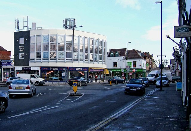
Queen Victoria House, 106 Victoria Road
Queen Victoria House is an undistinguished looking modern office & shops block, built a few years ago at this busy road junction in Old Town. It also has a frontage to Albert Street, and is seen here from Bath Road. There is an interesting array of communications equipment on the building's roof.
Location:51.552427, -1.777121
Road:A4289
Date:26 11 2009
Photographer:� Copyright P L Chadwick and licensed for reuse under this Creative Commons Licence
Source:Geograph

Map

Y btmleft.gifY btmright.gif

Galleries  | A4289 | Swindon

File history

Click on a date/time to view the file as it appeared at that time.

Date/TimeThumbnailDimensionsUserComment
current13:49, 8 March 2010Thumbnail for version as of 13:49, 8 March 2010640 × 439 (77 KB)Jeni (talk | contribs)'''Queen Victoria House, 106 Victoria Road'''<br/>Queen Victoria House is an undistinguished looking modern office & shops block, built a few years ago at this busy road junction in Old Town. It also has a frontage to Albert Street, and is seen here from

The following page uses this file:

Metadata

SABRE - The Society for All British and Irish Road Enthusiasts
Discuss - Digest - Discover - Help