File:Queensferry junction.png
Jump to navigation
Jump to search

Size of this preview: 800 × 536 pixels. Other resolutions: 2,560 × 1,716 pixels | 3,611 × 2,421 pixels.
Original file (3,611 × 2,421 pixels, file size: 3.2 MB, MIME type: image/png)
| |||||||||||||||||||||||||
|
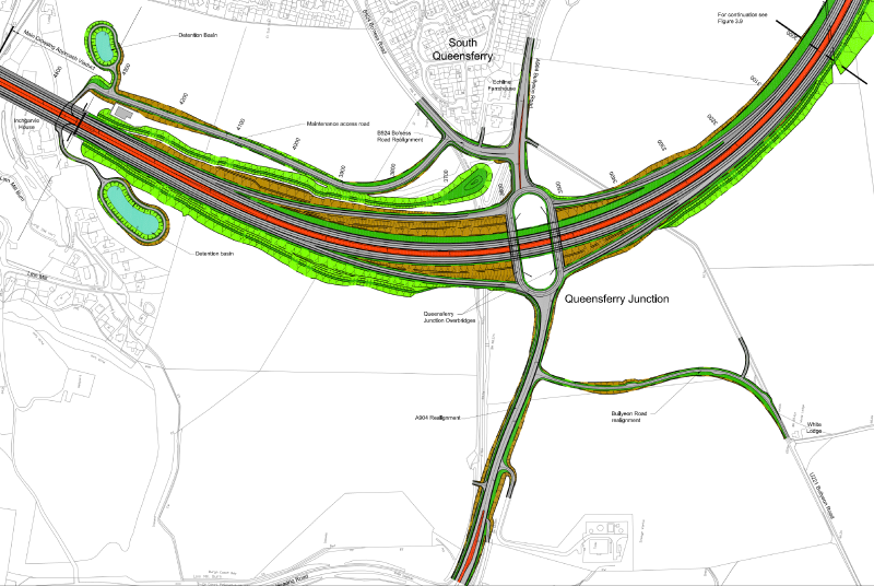
Galleries | M90 | Queensferry Junction | Forth Replacement Crossing | ||
File history
Click on a date/time to view the file as it appeared at that time.
| Date/Time | Thumbnail | Dimensions | User | Comment | |
|---|---|---|---|---|---|
| current | 19:56, 12 April 2013 | | 3,611 × 2,421 (3.2 MB) | Andrum99 (talk | contribs) | plan of proposed Queensferry Junction |
File usage
The following page uses this file: