File:ROI-NI road border at Muff, County Donegal - Culmore, Co Londonderry - Geograph - 269038.jpg
Jump to navigation
Jump to search

No higher resolution available.
ROI-NI_road_border_at_Muff,_County_Donegal_-_Culmore,_Co_Londonderry_-_Geograph_-_269038.jpg (640 × 480 pixels, file size: 54 KB, MIME type: image/jpeg)
| |||||||||||||||||||||||||
|
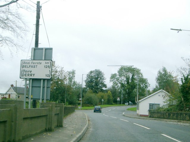
Galleries | R238 | A2 (Northern Ireland) | Wild Atlantic Way | Route Confirmation Sign | ||
File history
Click on a date/time to view the file as it appeared at that time.
| Date/Time | Thumbnail | Dimensions | User | Comment | |
|---|---|---|---|---|---|
| current | 19:18, 3 February 2011 | | 640 × 480 (54 KB) | Si404 (talk | contribs) | '''ROI-NI road border at Muff, County Donegal - Culmore, Co Londonderry'''<br/>Road border of Muff, Co Donegal, Republic of Ireland (R239 road) / Culmore, Co Londonderry, Northern Ireland (A2 road).<br /> Republic of Ireland distance sign located in fore |
File usage
The following page uses this file: