File:Railway bridge over Rudyard Road - Geograph - 3060180.jpg
Jump to navigation
Jump to search

No higher resolution available.
Railway_bridge_over_Rudyard_Road_-_Geograph_-_3060180.jpg (640 × 480 pixels, file size: 102 KB, MIME type: image/jpeg)
| |||||||||||||||||||||||||
|
Galleries | B5331 | ||
File history
Click on a date/time to view the file as it appeared at that time.
| Date/Time | Thumbnail | Dimensions | User | Comment | |
|---|---|---|---|---|---|
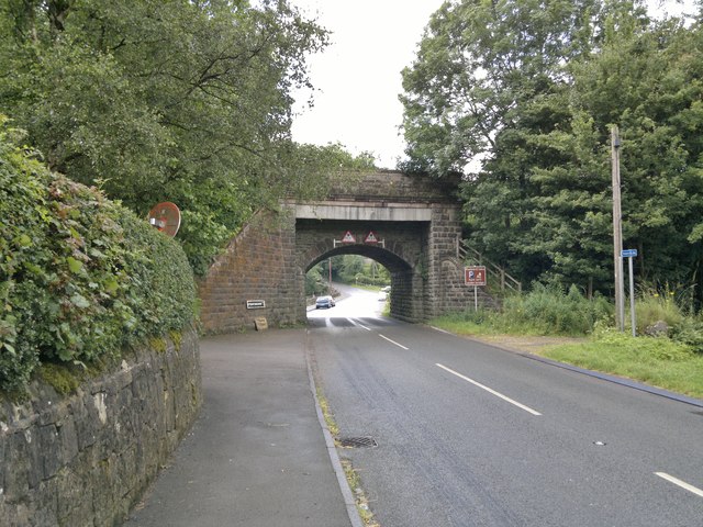
| current | 19:16, 6 July 2016 | | 640 × 480 (102 KB) | Vlad (talk | contribs) | '''Railway bridge over Rudyard Road''' Originally built for the North Staffordshire Railway about 1844 and in use until the standard gauge line finally closed in 1964. Now used by the miniature Rudyard Lake Steam Railway. |
File usage
The following 2 pages use this file: