File:Ramsgate Ferry Terminal - Geograph - 503178.jpg
Jump to navigation
Jump to search

No higher resolution available.
Ramsgate_Ferry_Terminal_-_Geograph_-_503178.jpg (640 × 480 pixels, file size: 132 KB, MIME type: image/jpeg)
| |||||||||||||||||||||||||
|
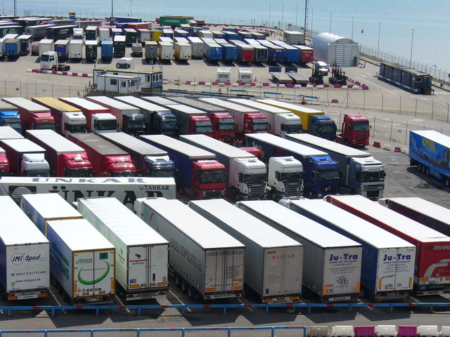
Galleries | A299 | Ramsgate - Ostend ferry | ||
File history
Click on a date/time to view the file as it appeared at that time.
| Date/Time | Thumbnail | Dimensions | User | Comment | |
|---|---|---|---|---|---|
| current | 13:55, 23 May 2010 | | 640 × 480 (132 KB) | Abeaton (talk | contribs) | '''Ramsgate Ferry Terminal'''<br/>A new ferry terminal, west of Royal Harbour, has been recently built and caters mainly for Trans Europa Freight traffic to and from Ostend. |
File usage
The following 3 pages use this file: