File:River Arun- A283 Stopham Road bridge - Geograph - 1502077.jpg

From Roader's Digest: The SABRE Wiki
Jump to navigation Jump to search

River_Arun-_A283_Stopham_Road_bridge_-_Geograph_-_1502077.jpg(640 × 480 pixels, file size: 105 KB, MIME type: image/jpeg)

Y topleft.gifY topright.gif
Description:
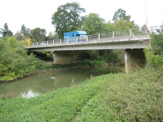
River Arun- A283 Stopham Road bridge
The new bridge replaced <a href='http://www.geograph.org.uk/photo/1502048'>TQ0218 : River Arun: Stopham Bridge</a> as the crossing of the A283 over the River Arun. The bridge was completed in 1986 and consists of four spans supported on reinforced concrete piers and abutments. Because of the poor ground conditions the piers are supported on piles that go down some 15 to 20 metres to the sandstone rock formation beneath the surface. A blue horsebox trundles across the bridge heading in the direction of Pulborough.
Location:50.955840, -0.535329
Road:A283
Date:17 09 2009
Photographer:� Copyright Nigel Cox and licensed for reuse under this Creative Commons Licence
Source:Geograph

Map

Y btmleft.gifY btmright.gif

Galleries  | A283 | Stopham Bridge | Pictures from Geograph

File history

Click on a date/time to view the file as it appeared at that time.

Date/TimeThumbnailDimensionsUserComment
current18:26, 16 May 2010Thumbnail for version as of 18:26, 16 May 2010640 × 480 (105 KB)Bob@romiley1 (talk | contribs)'''River Arun- A283 Stopham Road bridge'''<br/>The new bridge replaced <a href="http://www.geograph.org.uk/photo/1502048">TQ0218 : River Arun: Stopham Bridge</a> as the crossing of the A283 over the River Arun. The bridge was completed in 1986 and consist

The following 3 pages use this file:

Metadata

SABRE - The Society for All British and Irish Road Enthusiasts
Discuss - Digest - Discover - Help