File:River Avon, New Bridge - Geograph - 180182.jpg
Jump to navigation
Jump to search

No higher resolution available.
River_Avon,_New_Bridge_-_Geograph_-_180182.jpg (640 × 424 pixels, file size: 79 KB, MIME type: image/jpeg)
| |||||||||||||||||||||||||
|
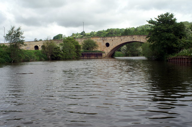
Galleries | A4/Bath - Chippenham | A4/Avonmouth - Bath | Newbridge (Bath) | ||
File history
Click on a date/time to view the file as it appeared at that time.
| Date/Time | Thumbnail | Dimensions | User | Comment | |
|---|---|---|---|---|---|
| current | 19:59, 12 June 2010 | | 640 × 424 (79 KB) | Abeaton (talk | contribs) | '''River Avon, New Bridge'''<br/>A road bridge carrying the A4 from the west of Bath towards Bristol. Looking downstream. |
File usage
The following 3 pages use this file: