File:River Derwent and Derwent Bridge,... (C) David Dixon - Geograph - 3932982.jpg
Jump to navigation
Jump to search

No higher resolution available.
River_Derwent_and_Derwent_Bridge,..._(C)_David_Dixon_-_Geograph_-_3932982.jpg (640 × 482 pixels, file size: 348 KB, MIME type: image/jpeg)
| |||||||||||||||||||||||||
|
Galleries | A5086 | A594 (Papcastle - Maryport) | Derwent Bridge (Cockermouth) | ||
File history
Click on a date/time to view the file as it appeared at that time.
| Date/Time | Thumbnail | Dimensions | User | Comment | |
|---|---|---|---|---|---|
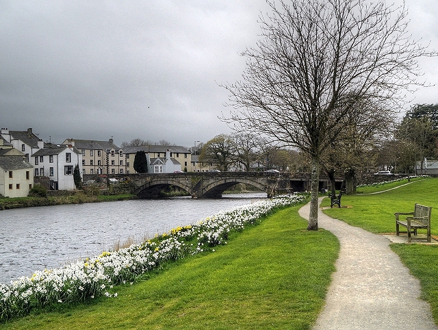
| current | 15:28, 31 October 2014 | | 640 × 482 (348 KB) | Jeni (talk | contribs) | '''River Derwent and Derwent Bridge,... (C) David Dixon '''<br/>Derwent Bridge carries the A5086 (Gote Road) over the river at Cockermouth. Dating from 1822, it is a Grade II listed building (English Heritage Building ID: 71648 <span class="nowrap"><a ... |
File usage
The following 4 pages use this file:
_David_Dixon_-_Geograph_-_3932982.jpg&oldid=505798)