File:River Suir Bridge, Waterford - Geograph - 6091859.jpg
Jump to navigation
Jump to search

No higher resolution available.
River_Suir_Bridge,_Waterford_-_Geograph_-_6091859.jpg (640 × 426 pixels, file size: 61 KB, MIME type: image/jpeg)
| |||||||||||||||||||||||||
|
Galleries | N25 | Thomas Francis Meagher Bridge | Pictures from Geograph | ||
File history
Click on a date/time to view the file as it appeared at that time.
| Date/Time | Thumbnail | Dimensions | User | Comment | |
|---|---|---|---|---|---|
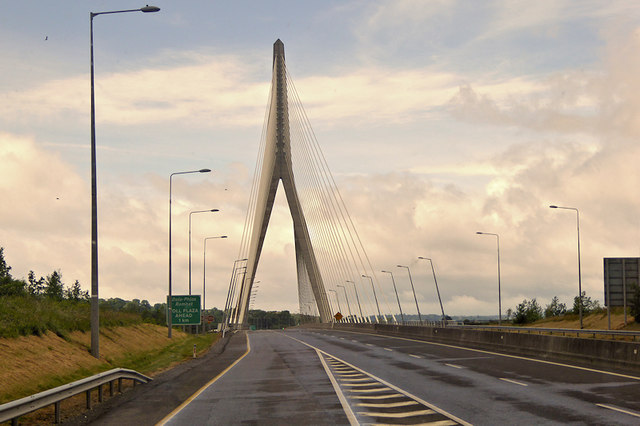
| current | 10:30, 24 February 2020 | | 640 × 426 (61 KB) | C2r (talk | contribs) | '''River Suir Bridge, Waterford''' The cable-stayed Suir Bridge with its 112 metre-tall tower, is a landmark structure for Waterford City and the surrounding areas. The tower is constructed on the south side of the river. A series of “stay cables” fan out from the top of the tower to support the main span at intervals of about 10 metres. |
File usage
The following 2 pages use this file: