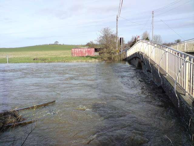
File:River Yeo flooding at Long Load bridge - Geograph - 658924.jpg
Jump to navigation
Jump to search

No higher resolution available.
River_Yeo_flooding_at_Long_Load_bridge_-_Geograph_-_658924.jpg (640 × 480 pixels, file size: 75 KB, MIME type: image/jpeg)
| |||||||||||||||||||||||||
|
Galleries | B3165 (Somerset) | Load Bridge | Traffic Signals | ||
File history
Click on a date/time to view the file as it appeared at that time.
| Date/Time | Thumbnail | Dimensions | User | Comment | |
|---|---|---|---|---|---|
| current | 17:59, 19 May 2011 | | 640 × 480 (75 KB) | Rileyrob (talk | contribs) | River Yeo flooding at Long Load bridge |
File usage
The following 2 pages use this file: