File:Road junction on the B2163 at West Farleigh - Geograph - 1758598.jpg

From Roader's Digest: The SABRE Wiki
Jump to navigation Jump to search

Road_junction_on_the_B2163_at_West_Farleigh_-_Geograph_-_1758598.jpg(640 × 480 pixels, file size: 114 KB, MIME type: image/jpeg)

Y topleft.gifY topright.gif
Description:
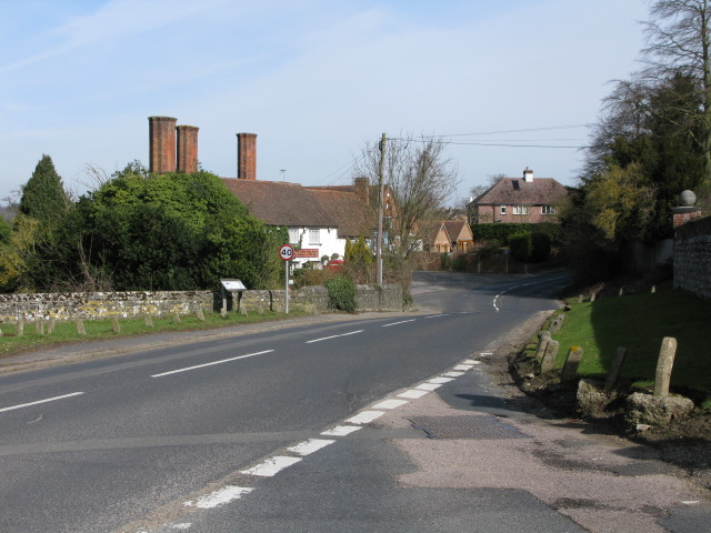
Road junction on the B2163 at West Farleigh
The B2010 and the B2163 merge at this point for a short distance before splitting again into two seperate roads. The building with tall chimneys is the Tickled Trout pub.
Location:51.246673, 0.452828
Road:B2163
Date:16 03 2010
Photographer:� Copyright Nick Smith and licensed for reuse under this Creative Commons Licence
Source:Geograph

Map

Y btmleft.gifY btmright.gif

Galleries  | B2163

File history

Click on a date/time to view the file as it appeared at that time.

Date/TimeThumbnailDimensionsUserComment
current12:14, 21 March 2010Thumbnail for version as of 12:14, 21 March 2010640 × 480 (114 KB)Jeni (talk | contribs)'''Road junction on the B2163 at West Farleigh'''<br/>The B2010 and the B2163 merge at this point for a short distance before splitting again into two seperate roads. The building with tall chimneys is the Tickled Trout pub.

The following 2 pages use this file:

Metadata

SABRE - The Society for All British and Irish Road Enthusiasts
Discuss - Digest - Discover - Help