File:Road signs, Cockfosters - Geograph - 1230533.jpg
Jump to navigation
Jump to search

No higher resolution available.
Road_signs,_Cockfosters_-_Geograph_-_1230533.jpg (640 × 487 pixels, file size: 75 KB, MIME type: image/jpeg)
| |||||||||||||||||||||||||
|
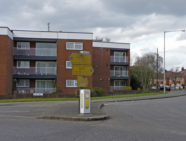
Galleries | A111 | A110 | Cat Hill Roundabout | Pictures from Geograph | Pre-Worboys Direction Signs | ||
File history
Click on a date/time to view the file as it appeared at that time.
| Date/Time | Thumbnail | Dimensions | User | Comment | |
|---|---|---|---|---|---|
| current | 16:12, 1 September 2021 | | 640 × 487 (75 KB) | C2r (talk | contribs) | '''Road signs, Cockfosters''' Old road signs at the junction of Cat Hill with the Cockfosters Road at the Cat Hill Roundabout. |
File usage
The following 3 pages use this file: