File:Roof of Meir Tunnel (under construction) - Geograph - 3262889.jpg
Jump to navigation
Jump to search

No higher resolution available.
Roof_of_Meir_Tunnel_(under_construction)_-_Geograph_-_3262889.jpg (640 × 459 pixels, file size: 93 KB, MIME type: image/jpeg)
| |||||||||||||||||||||||||
|
Galleries | A50 | Meir Tunnel | Meir Interchange | ||
File history
Click on a date/time to view the file as it appeared at that time.
| Date/Time | Thumbnail | Dimensions | User | Comment | |
|---|---|---|---|---|---|
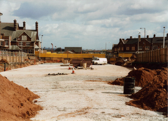
| current | 12:06, 1 June 2016 | | 640 × 459 (93 KB) | Jeni (talk | contribs) | '''Roof of Meir Tunnel (under construction)''' Probably taken during the summer of 1997, this photo shows the bare roof of the A50 road tunnel which now takes traffic under the centre of Meir. To the left is the now-demolished Kings Arms public house. ... |
File usage
There are no pages that use this file.
_-_Geograph_-_3262889.jpg&oldid=417155)