File:Rothersthorpe Services on the M1 by Northampton- aerial 2014 - Geograph - 4054641.jpg
Jump to navigation
Jump to search

Size of this preview: 400 × 600 pixels. Other resolution: 427 × 640 pixels.
Original file (427 × 640 pixels, file size: 62 KB, MIME type: image/jpeg)
| |||||||||||||||||||||||||
|
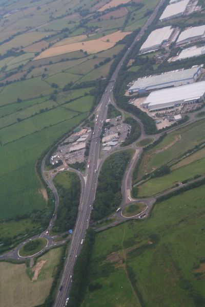
Galleries | M1 | A43 | Rothersthorpe Interchange | ||
File history
Click on a date/time to view the file as it appeared at that time.
| Date/Time | Thumbnail | Dimensions | User | Comment | |
|---|---|---|---|---|---|
| current | 14:20, 8 June 2016 | | 427 × 640 (62 KB) | Jeni (talk | contribs) | '''Rothersthorpe Services on the M1 by Northampton- aerial 2014''' Running under the roads is the Northampton Branch of the Grand Union Canal. |
File usage
The following 4 pages use this file: