File:Roundabout linking the A2 to the Shore Road - Geograph - 1094998.jpg
Jump to navigation
Jump to search

No higher resolution available.
Roundabout_linking_the_A2_to_the_Shore_Road_-_Geograph_-_1094998.jpg (640 × 480 pixels, file size: 31 KB, MIME type: image/jpeg)
| |||||||||||||||||||||||||
|
Galleries | A2 (Northern Ireland) | T21 (Northern Ireland) | Causeway Coastal Route | Roundabout | Newtownards | ||
File history
Click on a date/time to view the file as it appeared at that time.
| Date/Time | Thumbnail | Dimensions | User | Comment | |
|---|---|---|---|---|---|
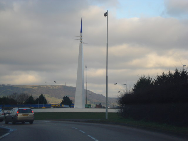
| current | 12:37, 16 June 2010 | | 640 × 480 (31 KB) | Si404 (talk | contribs) | '''Roundabout linking the A2 to the Shore Road'''<br/>The monument at the roundabout linking the A2 to the Shore Road. This depicts the monks pointed hat in blue (Whiteabbey) and the white arrows the sails of a yacht. |
File usage
The following 2 pages use this file: