File:Saddle Junction - Geograph - 878459.jpg

From Roader's Digest: The SABRE Wiki
Jump to navigation Jump to search

Saddle_Junction_-_Geograph_-_878459.jpg(640 × 426 pixels, file size: 47 KB, MIME type: image/jpeg)

Y topleft.gifY topright.gif
Description:
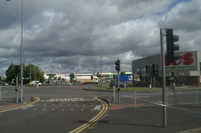
Saddle Junction
The Fire Station is to the left. To allow the engines to avoid congestion on the large roundabout a short-cut has been devised. Traffic is stopped by the lights to allow machines to swing across the traffic flow to head westwards.
Location:53.541219, -2.650938
Road:A49, A577
Date:10 07 2008
Photographer:� Copyright David Long and licensed for reuse under this Creative Commons Licence
Source:Geograph

Map

Y btmleft.gifY btmright.gif

Galleries  | A49 | A577 | A49 Named Junctions | S3 | Roundabout

File history

Click on a date/time to view the file as it appeared at that time.

Date/TimeThumbnailDimensionsUserComment
current20:21, 2 October 2010Thumbnail for version as of 20:21, 2 October 2010640 × 426 (47 KB)Bob@romiley1 (talk | contribs)'''Saddle Junction'''<br/>The Fire Station is to the left. To allow the engines to avoid congestion on the large roundabout a short-cut has been devised. Traffic is stopped by the lights to allow machines to swing across the traffic flow to head westwards

The following 3 pages use this file:

Metadata

SABRE - The Society for All British and Irish Road Enthusiasts
Discuss - Digest - Discover - Help