File:Saint Alkmunds Way (A601), Derby (C) Eamon Curry - Geograph - 1701302.jpg

From Roader's Digest: The SABRE Wiki
Jump to navigation Jump to search

Saint_Alkmunds_Way_(A601),_Derby_(C)_Eamon_Curry_-_Geograph_-_1701302.jpg(640 × 480 pixels, file size: 50 KB, MIME type: image/jpeg)

Y topleft.gifY topright.gif
Description:
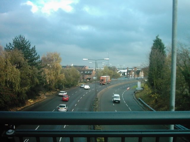
Saint Alkmunds Way (A601), Derby (C) Eamon Curry
This photo was taken over the new footbridge that passes over Saint Alkmunds Way (A601) that is basically the A52. To the left of this footbridge is Saint Marys Catholic Church and to the right is King Street (A6) and Queen Street.
Location:52.926920, -1.477537
Road:A601
Date:19 10 2007
Photographer:Eamon Curry and licensed for reuse under this Creative Commons Licence
Source:Geograph

Map

Y btmleft.gifY btmright.gif

Galleries  | A601 | Derby

File history

Click on a date/time to view the file as it appeared at that time.

Date/TimeThumbnailDimensionsUserComment
current16:10, 6 March 2014Thumbnail for version as of 16:10, 6 March 2014640 × 480 (50 KB)Vlad (talk | contribs)'''Saint Alkmunds Way (A601), Derby (C) Eamon Curry '''<br/>This photo was taken over the new footbridge that passes over Saint Alkmunds Way (A601) that is basically the A52. To the left of this footbridge is Saint Marys Catholic Church and to the righ...

The following 3 pages use this file:

Metadata

SABRE - The Society for All British and Irish Road Enthusiasts
Discuss - Digest - Discover - Help