File:Saint Giles, Cripplegate (C) David Wright - Geograph - 714744.jpg
Jump to navigation
Jump to search

No higher resolution available.
Saint_Giles,_Cripplegate_(C)_David_Wright_-_Geograph_-_714744.jpg (640 × 408 pixels, file size: 140 KB, MIME type: image/jpeg)
| |||||||||||||||||||||||||
File history
Click on a date/time to view the file as it appeared at that time.
| Date/Time | Thumbnail | Dimensions | User | Comment | |
|---|---|---|---|---|---|
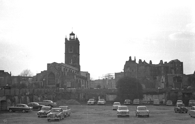
| current | 19:45, 7 December 2014 | | 640 × 408 (140 KB) | Vlad (talk | contribs) | '''Saint Giles, Cripplegate (C) David Wright '''<br/>Photo taken c1958. The bomb site in the foreground is being used as a temporary car park. For a recent view taken from this site see <a href="http://www.geograph.org.uk/photo/559771">TQ3281 : City pa... |
File usage
The following 2 pages use this file:
_David_Wright_-_Geograph_-_714744.jpg&oldid=392117)