File:Sea wall promenade, around Tilbury Fort (C) David Anstiss - Geograph - 3182688.jpg
Jump to navigation
Jump to search

No higher resolution available.
Sea_wall_promenade,_around_Tilbury_Fort_(C)_David_Anstiss_-_Geograph_-_3182688.jpg (640 × 480 pixels, file size: 45 KB, MIME type: image/jpeg)
| |||||||||||||||||||||||||
File history
Click on a date/time to view the file as it appeared at that time.
| Date/Time | Thumbnail | Dimensions | User | Comment | |
|---|---|---|---|---|---|
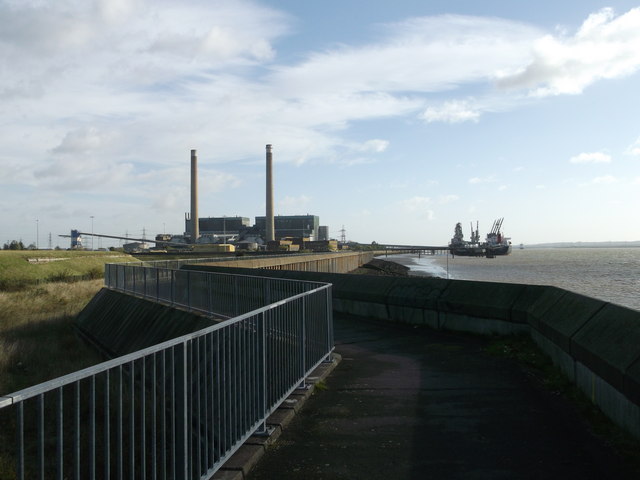
| current | 13:30, 8 March 2014 | | 640 × 480 (45 KB) | Si404 (talk | contribs) | '''Sea wall promenade, around Tilbury Fort (C) David Anstiss '''<br/>This River Thames promenade leads around the Fort from Fort Road towards Tilbury Power Station.<br /> <br /> It is used by National Cycle Route 13 leading towards the West Tilbury M... |
_David_Anstiss_-_Geograph_-_3182688.jpg&oldid=366432)