File:Sign at Wateringbury, Kent - Coppermine - 6346.jpg
Jump to navigation
Jump to search

Size of this preview: 450 × 600 pixels. Other resolution: 486 × 648 pixels.
Original file (486 × 648 pixels, file size: 351 KB, MIME type: image/jpeg)
| |||||||||||||||||||||||||
|
Galleries | A26 | B2015 | Heart of Kent Country Tour | Pre-Worboys Fingerpost Signs | B2000-B2099 | B2000-B2999 | B Roads | ||
File history
Click on a date/time to view the file as it appeared at that time.
| Date/Time | Thumbnail | Dimensions | User | Comment | |
|---|---|---|---|---|---|
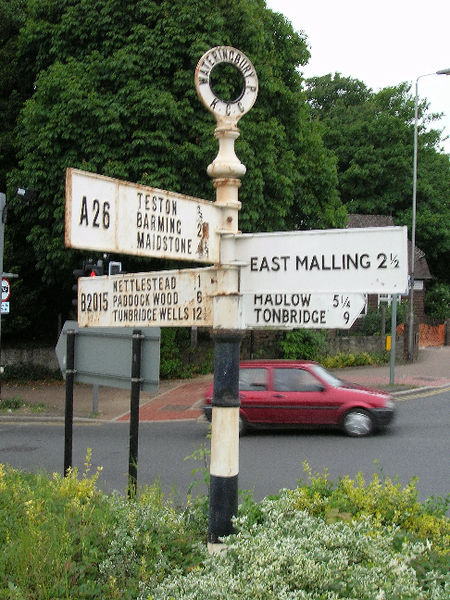
| current | 12:18, 29 June 2010 | | 486 × 648 (351 KB) | Bob@romiley1 (talk | contribs) | '''Sign at Wateringbury, Kent''' There is a new sign, too, which directs Tunbridge Wells traffic further along the A26. But the B2015 is still the more obvious route. <small>''Originally uploaded to Coppermine on Jun 11, 2006 by Simon A6(M)''</small> |
File usage
The following 7 pages use this file: