File:Sign on M69 - Geograph - 1741662.jpg
Jump to navigation
Jump to search

No higher resolution available.
Sign_on_M69_-_Geograph_-_1741662.jpg (640 × 479 pixels, file size: 49 KB, MIME type: image/jpeg)
| |||||||||||||||||||||||||
|
Galleries | M69 | Ansty Interchange | Coventry | Fork sign | ||
File history
Click on a date/time to view the file as it appeared at that time.
| Date/Time | Thumbnail | Dimensions | User | Comment | |
|---|---|---|---|---|---|
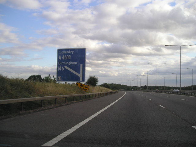
| current | 21:32, 7 March 2010 | | 640 × 479 (49 KB) | Jeni (talk | contribs) | '''Sign on M69'''<br/>An original fork sign on the M69 approaching the M6 and A46 near Coventry. The sign pre-dates the Coventry Eastern Bypass (A46) as you can see where a "No Entry" symbol would have been placed over the straight ahead route. |
File usage
The following page uses this file: