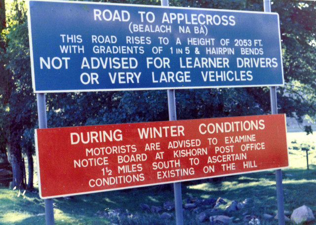
File:Signs for the road to Applecross in 1975 - Geograph - 2315752.jpg
Jump to navigation
Jump to search

No higher resolution available.
Signs_for_the_road_to_Applecross_in_1975_-_Geograph_-_2315752.jpg (640 × 456 pixels, file size: 133 KB, MIME type: image/jpeg)
| |||||||||||||||||||||||||
|
Galleries | A896 | Wester Ross Coastal Trail | NC500 | Single track road | Bealach na Ba | ||
File history
Click on a date/time to view the file as it appeared at that time.
| Date/Time | Thumbnail | Dimensions | User | Comment | |
|---|---|---|---|---|---|
| current | 21:43, 1 January 2012 | | 640 × 456 (133 KB) | Bryn666 (talk | contribs) | Signs for the road to Applecross in 1975 |
File usage
There are no pages that use this file.