File:Site of Devynock & Sennybridge station - Geograph - 3411161.jpg
Jump to navigation
Jump to search

No higher resolution available.
Site_of_Devynock_&_Sennybridge_station_-_Geograph_-_3411161.jpg (640 × 393 pixels, file size: 126 KB, MIME type: image/jpeg)
| |||||||||||||||||||||||||
File history
Click on a date/time to view the file as it appeared at that time.
| Date/Time | Thumbnail | Dimensions | User | Comment | |
|---|---|---|---|---|---|
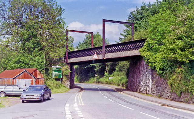
| current | 22:30, 9 August 2020 | | 640 × 393 (126 KB) | Bryn666 (talk | contribs) | '''Site of Devynock & Sennybridge station''' View eastward on the A40 road towards Brecon: ex- GWR (Neath & Brecon) Brecon - Neath (Riverside) line. The line had been closed from 15/10/62, but the track-bed over this bridge was utilised for the A4067 by-pass road: the station had been off to the right. |
File usage
The following page uses this file: