File:Skipper's Bridge - Geograph - 1383479.jpg
Jump to navigation
Jump to search

Size of this preview: 400 × 600 pixels. Other resolution: 427 × 640 pixels.
Original file (427 × 640 pixels, file size: 240 KB, MIME type: image/jpeg)
| |||||||||||||||||||||||||
|
Galleries | A7 | Borders Historic Route | Skippers Bridge | ||
File history
Click on a date/time to view the file as it appeared at that time.
| Date/Time | Thumbnail | Dimensions | User | Comment | |
|---|---|---|---|---|---|
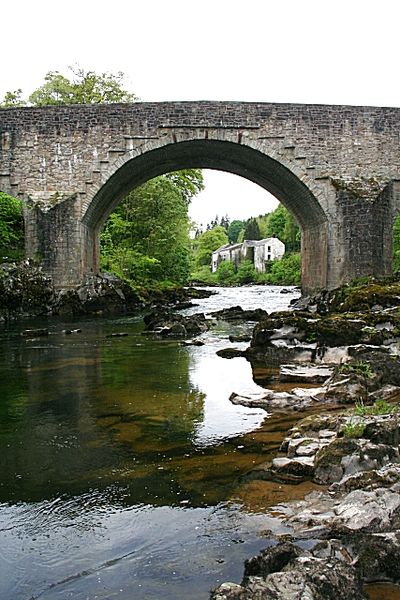
| current | 13:17, 26 July 2010 | | 427 × 640 (240 KB) | Bob@romiley1 (talk | contribs) | '''Skipper's Bridge'''<br/>The bridge carries the A7 across the River Esk just south of Langholm. It was not built for modern traffic, and a set of traffic lights controls its use. This view is looking upstream towards Langholm. |
File usage
The following page uses this file: