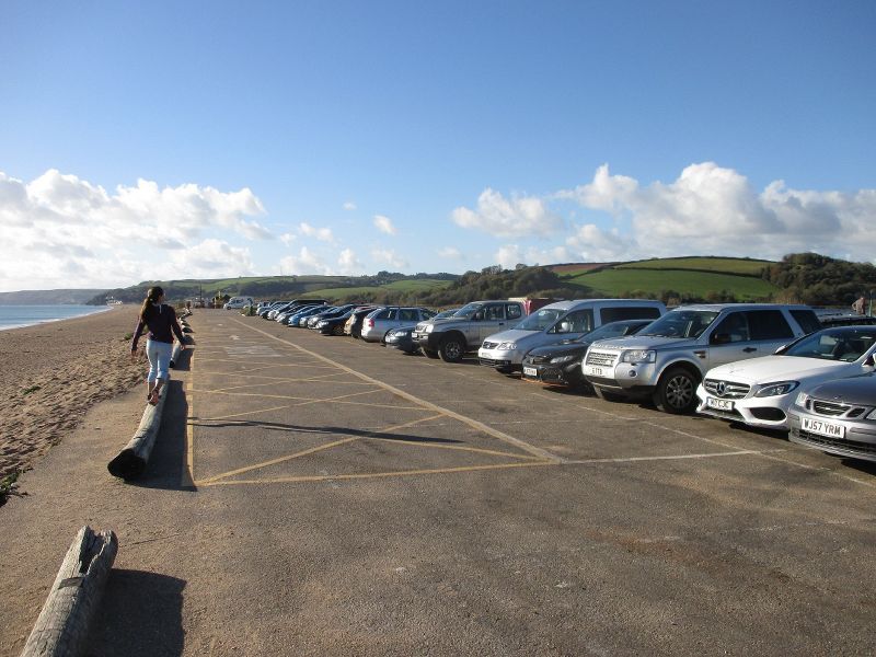
The car park off the A379 at the Slapton Sands Memorial. Compare and contrast with the latest street view shot and notice the amount lost during Storm Emma. The left edge of the car park also shows evidence of the damage. The A379 had just opened this week following its move inland by 20 metres.
The car park off the A379 at the Slapton Sands Memorial. Compare and contrast with the latest street view shot and notice the amount lost during Storm Emma. The left edge of the car park also shows evidence of the damage. The A379 had just opened this...
File usage
There are no pages that use this file.
Metadata
This file contains additional information, probably added from the digital camera or scanner used to create or digitise it.
If the file has been modified from its original state, some details may not fully reflect the modified file.
