File:Snaefell from The Bungalow - Isle of Man (C) Jon Wornham - Geograph - 31598.jpg
Jump to navigation
Jump to search

No higher resolution available.
Snaefell_from_The_Bungalow_-_Isle_of_Man_(C)_Jon_Wornham_-_Geograph_-_31598.jpg (640 × 456 pixels, file size: 82 KB, MIME type: image/jpeg)
| |||||||||||||||||||||||||
|
Galleries | A18 (Isle of Man) | TT Circuit | A14 (Isle of Man) | Bungalow | ||
File history
Click on a date/time to view the file as it appeared at that time.
| Date/Time | Thumbnail | Dimensions | User | Comment | |
|---|---|---|---|---|---|
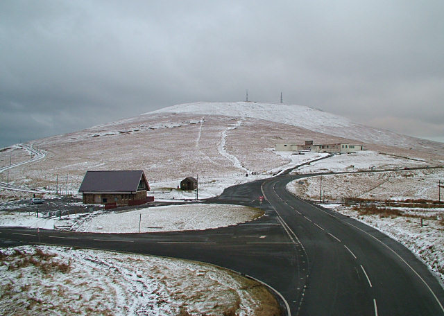
| current | 21:29, 17 June 2013 | | 640 × 456 (82 KB) | Si404 (talk | contribs) | '''Snaefell from The Bungalow - Isle of Man (C) Jon Wornham '''<br/>Snaefell living up to its name of 'Snow Mountain'. Quite unusually the Mountain Road was open in snow conditions allowing this picture, which was taken from the footbridge over the roa... |
File usage
The following 3 pages use this file:
_Jon_Wornham_-_Geograph_-_31598.jpg&oldid=347735)