File:Snodland Town Centre - Geograph - 147070.jpg
Jump to navigation
Jump to search

No higher resolution available.
Snodland_Town_Centre_-_Geograph_-_147070.jpg (640 × 480 pixels, file size: 84 KB, MIME type: image/jpeg)
| |||||||||||||||||||||||||
|
Galleries | C22 (Kent) | C491 (Kent) | ||
File history
Click on a date/time to view the file as it appeared at that time.
| Date/Time | Thumbnail | Dimensions | User | Comment | |
|---|---|---|---|---|---|
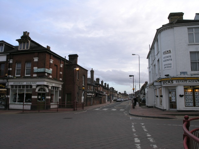
| current | 13:57, 8 September 2020 | | 640 × 480 (84 KB) | Frediculous biggs (talk | contribs) | '''Snodland Town Centre''' Snodland town centre has changed little since the 1920s, save for modern railings road signs and some incredibly unsightly CCTV poles. Even the bakery still sports the Hovis logo, which could be observed on a period post card. The C491 is to the centre; the C22 to the right |
File usage
The following 2 pages use this file: