File:Southward on A21 (M) Sevenoaks-Tonbridge by-pass), 1983 - Geograph - 4123928.jpg
Jump to navigation
Jump to search

No higher resolution available.
Southward_on_A21_(M)_Sevenoaks-Tonbridge_by-pass),_1983_-_Geograph_-_4123928.jpg (640 × 380 pixels, file size: 92 KB, MIME type: image/jpeg)
| |||||||||||||||||||||||||
|
Galleries | A21(M) | A21 | M25 | Chevening Interchange | ||
File history
Click on a date/time to view the file as it appeared at that time.
| Date/Time | Thumbnail | Dimensions | User | Comment | |
|---|---|---|---|---|---|
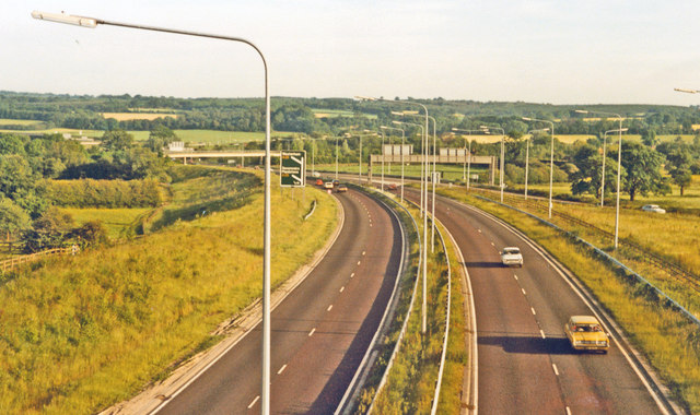
| current | 07:12, 24 May 2016 | | 640 × 380 (92 KB) | C2r (talk | contribs) | '''Southward on A21 (M) Sevenoaks-Tonbridge by-pass), 1983''' View from a side-road near Chipstead. Not much traffic - yet. |
File usage
The following 2 pages use this file:
_Sevenoaks-Tonbridge_by-pass),_1983_-_Geograph_-_4123928.jpg&oldid=415993)