File:Splott and Adamsdown Interchanges.png
Jump to navigation
Jump to search

No higher resolution available.
Splott_and_Adamsdown_Interchanges.png (580 × 600 pixels, file size: 75 KB, MIME type: image/png)
| |||||||||||||||||||||||||
|
Galleries | Hook Road | ||
File history
Click on a date/time to view the file as it appeared at that time.
| Date/Time | Thumbnail | Dimensions | User | Comment | |
|---|---|---|---|---|---|
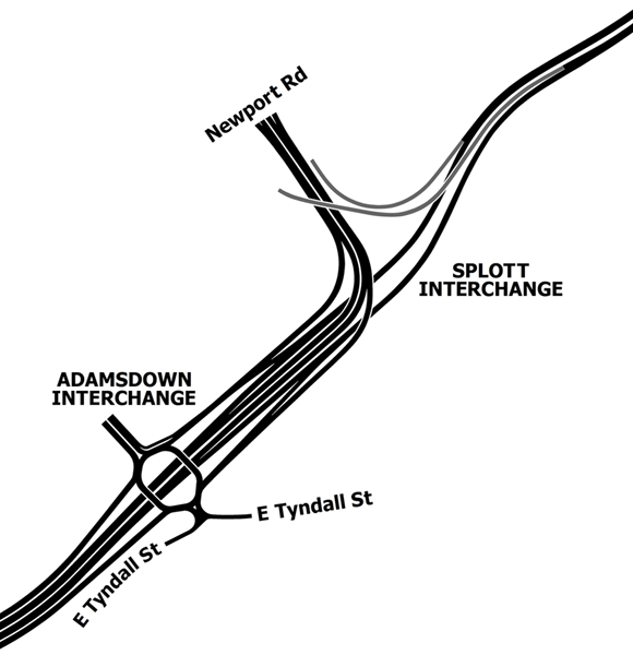
| current | 21:11, 10 June 2014 | | 580 × 600 (75 KB) | Truvelo (talk | contribs) | Layout of Splott and Adamsdown Interchanges as part of the unbuilt Hook Road in Cardiff. The two junctions would effectively work as one due to their close proximity to one another. The slip roads in grey were deleted from plans e... |
File usage
The following 3 pages use this file: