File:St. Albans Road (C) Martin Addison - Geograph - 1577944.jpg

From Roader's Digest: The SABRE Wiki
Jump to navigation Jump to search

St._Albans_Road_(C)_Martin_Addison_-_Geograph_-_1577944.jpg(640 × 403 pixels, file size: 206 KB, MIME type: image/jpeg)

Y topleft.gifY topright.gif
Description:
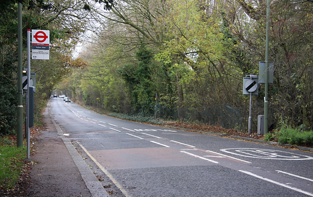
St. Albans Road (C) Martin Addison
The A1081 looking in the St. Albans direction from the outskirts of Barnet. The speed limit changes here from 30mph to the national speed limit. The bus stop is the last one that Oyster cards are valid to - beyond here you need to buy a ticket on the Uno operated 614 route to Hatfield. This used to be part of the 84 bus route, but that was diverted via Potters Bar in 1989. Sorry there's no bus in the picture...No service on a Sunday!
Location:51.660781, -0.206629
Road:A1081
Date:08 11 2009
Photographer:Martin Addison and licensed for reuse under this Creative Commons Licence
Source:Geograph

Map

Y btmleft.gifY btmright.gif

Galleries  | A1081 | Barnet

File history

Click on a date/time to view the file as it appeared at that time.

Date/TimeThumbnailDimensionsUserComment
current15:24, 22 May 2014Thumbnail for version as of 15:24, 22 May 2014640 × 403 (206 KB)Vlad (talk | contribs)'''St. Albans Road (C) Martin Addison '''<br/>The A1081 looking in the St. Albans direction from the outskirts of Barnet. The speed limit changes here from 30mph to the national speed limit. The bus stop is the last one that Oyster cards are valid to...

The following 3 pages use this file:

Metadata

SABRE - The Society for All British and Irish Road Enthusiasts
Discuss - Digest - Discover - Help