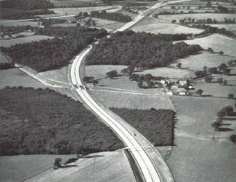
Part of the St Alban's bypass in Spring 1959, what was then the M10, looking west towards the M1 junction in the distance. This is now the A414, at a place called St Michael, about 1 mile east of the M1, with Windridge Farm clearly visible on the right. The wood the M10 passes through is called Birch Wood.
In the distance you can see the A4147 passing under the M10 and over the M1.
Part of the St Alban's bypass in Spring 1959, what was then the M10, looking west towards the M1 junction in the distance. This is now the A414, at a place called St Michael, about 1 mile east of the M1, with Windridge Farm clearly visible on the right...
