File:Stagg Hill - Geograph - 1894040.jpg
Jump to navigation
Jump to search

No higher resolution available.
Stagg_Hill_-_Geograph_-_1894040.jpg (640 × 415 pixels, file size: 104 KB, MIME type: image/jpeg)
| |||||||||||||||||||||||||
|
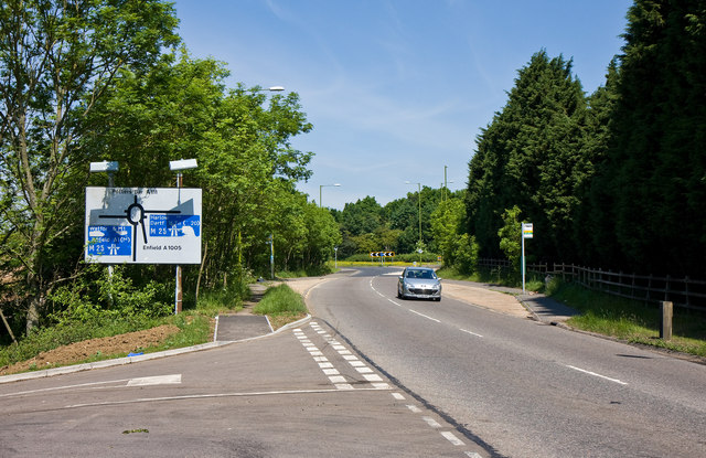
Galleries | A111 | Potters Bar Interchange | ||
File history
Click on a date/time to view the file as it appeared at that time.
| Date/Time | Thumbnail | Dimensions | User | Comment | |
|---|---|---|---|---|---|
| current | 16:13, 13 June 2016 | | 640 × 415 (104 KB) | Jeni (talk | contribs) | '''Stagg Hill''' This is the high point of the A111 close to junction 24 of the M25 motorway. The junction sign on the left has seen some modification over time and is now in need of repair. The road in the foreground gives access to Chase Farm - thi... |
File usage
The following 3 pages use this file: