File:Stair Bridge - Geograph - 578932.jpg

From Roader's Digest: The SABRE Wiki
Jump to navigation Jump to search

Stair_Bridge_-_Geograph_-_578932.jpg(640 × 480 pixels, file size: 102 KB, MIME type: image/jpeg)

Y topleft.gifY topright.gif
Description:
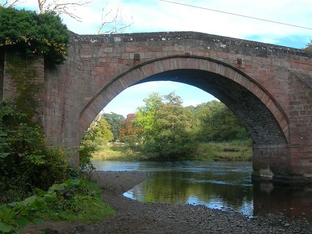
Stair Bridge
Looking up the River Ayr. Stair Bridge was erected in 1745, with 3 masonry arches on triangular cutwaters. Within 11 years, the foundations were noted as being weak, and old milestones were used in the river bed to help protect the pier footings. (Source: 'The River Ayr Way', by Dane Love.)
Location:55.480180, -4.474133
Road:B730
Date:05 10 2007
Photographer:� Copyright Mary and Angus Hogg and licensed for reuse under this Creative Commons Licence
Source:Geograph

Map

Y btmleft.gifY btmright.gif

Galleries  | B730 | Stair Bridge

File history

Click on a date/time to view the file as it appeared at that time.

Date/TimeThumbnailDimensionsUserComment
current12:59, 23 July 2010Thumbnail for version as of 12:59, 23 July 2010640 × 480 (102 KB)Bob@romiley1 (talk | contribs)'''Stair Bridge'''<br/>Looking up the River Ayr. Stair Bridge was erected in 1745, with 3 masonry arches on triangular cutwaters. Within 11 years, the foundations were noted as being weak, and old milestones were used in the river bed to help protect th

The following page uses this file:

Metadata

SABRE - The Society for All British and Irish Road Enthusiasts
Discuss - Digest - Discover - Help