File:Stanley Bridge, Kirkby Lonsdale, Cumbria - Geograph - 52754.jpg

From Roader's Digest: The SABRE Wiki
Jump to navigation Jump to search

Stanley_Bridge,_Kirkby_Lonsdale,_Cumbria_-_Geograph_-_52754.jpg(640 × 480 pixels, file size: 128 KB, MIME type: image/jpeg)

Y topleft.gifY topright.gif
Description:
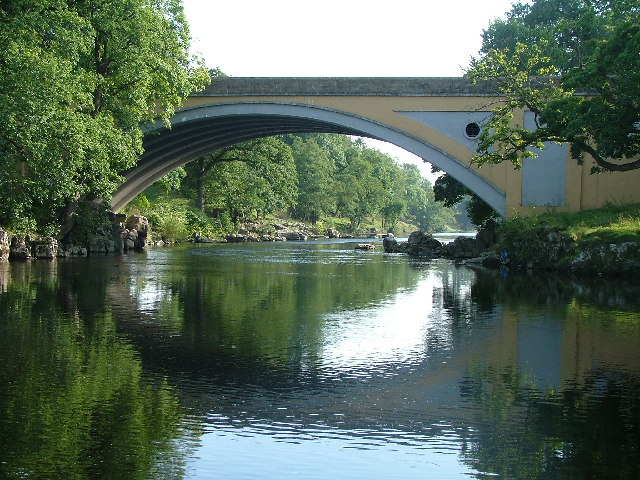
Stanley Bridge, Kirkby Lonsdale, Cumbria
Stanley Bridge carries the A65 over the River Lune near the Cumbria/Lancashire border at Kirkby Lonsdale. It is located just 100yds south of the better known but narrow Devil's Bridge which it replaced in 1932. SD616781
Location:54.200796, -2.591670
Road:A65
Date:12 09 2005
Photographer:� Copyright Ralph Rawlinson and licensed for reuse under this Creative Commons Licence
Source:Geograph

Map

Y btmleft.gifY btmright.gif

Galleries  | A65 | Kirkby Lonsdale | Stanley Bridge

File history

Click on a date/time to view the file as it appeared at that time.

Date/TimeThumbnailDimensionsUserComment
current13:10, 2 August 2010Thumbnail for version as of 13:10, 2 August 2010640 × 480 (128 KB)Bob@romiley1 (talk | contribs)'''Stanley Bridge, Kirkby Lonsdale, Cumbria'''<br/>Stanley Bridge carries the A65 over the River Lune near the Cumbria/Lancashire border at Kirkby Lonsdale. It is located just 100yds south of the better known but narrow Devil's Bridge which it replaced in

The following 2 pages use this file:

Metadata

SABRE - The Society for All British and Irish Road Enthusiasts
Discuss - Digest - Discover - Help