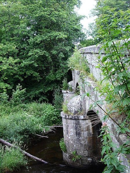
Steps Bridge Across the River Teign near Dunsford. The first bridge was built here in 1710, replacing stepping stone across the weir dam <a title='http://www.geograph.org.uk/photo/49049' rel='nofollow' href='http://www.geograph.org.uk/photo/49049'>Link</a><img style='padding-left:2px;' alt='External link' title='External link - shift click to open in new window' src='http://s0.geograph.org.uk/img/external.png' width='10' height='10'/>. Many accidents had occurred, and it was built as a result of 'the loss of a man and a woman who were taken downstream and drowned together with their horses'. The current bridge bears the date 1816 but building had started in 1814. The contractors had deviated from the contract by building it 2 feet too low and on shallow foundations so money was withheld until things were put right.
'''Steps Bridge'''<br/>Across the River Teign near Dunsford. The first bridge was built here in 1710, replacing stepping stone across the weir dam <span class="nowrap"><a title="http://www.geograph.org.uk/photo/49049" rel="nofollow" href="http://www.geogr
