File:Strome-ferry-1939.jpg
Jump to navigation
Jump to search

Size of this preview: 557 × 600 pixels. Other resolution: 600 × 646 pixels.
Original file (600 × 646 pixels, file size: 214 KB, MIME type: image/jpeg)
| |||||||||||||||||||||||||
|
Galleries | A890 | A896 | B856 | Bartholomews Mapping | B857 (Lochcarron - Shieldaig) | Strome Ferry | ||
File history
Click on a date/time to view the file as it appeared at that time.
| Date/Time | Thumbnail | Dimensions | User | Comment | |
|---|---|---|---|---|---|
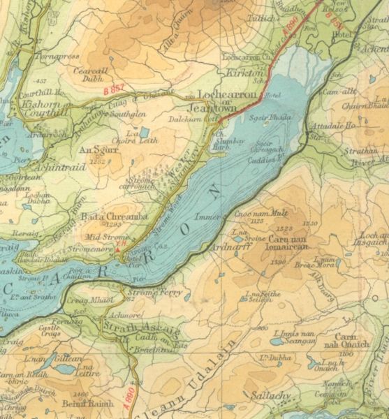
| current | 08:59, 1 January 2010 | | 600 × 646 (214 KB) | Rileyrob (talk | contribs) | {{Information |description = The A890 using Strome Ferry in 1939, before the new road was built along the southern shore of Loch Carron |day = |month = |year = 1939 |photographer = |source = Barts Half Inch Sheet 54 |road |
File usage
The following 5 pages use this file: