File:Struy Bridge - Geograph - 972163.jpg
Jump to navigation
Jump to search

No higher resolution available.
Struy_Bridge_-_Geograph_-_972163.jpg (640 × 426 pixels, file size: 124 KB, MIME type: image/jpeg)
| |||||||||||||||||||||||||
|
Galleries | A831 | Struy Bridge | ||
File history
Click on a date/time to view the file as it appeared at that time.
| Date/Time | Thumbnail | Dimensions | User | Comment | |
|---|---|---|---|---|---|
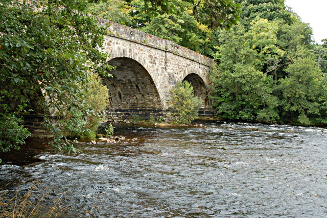
| current | 12:13, 28 July 2010 | | 640 × 426 (124 KB) | Bob@romiley1 (talk | contribs) | '''Struy Bridge'''<br/>This fine road bridge was built by Joseph Mitchell around the 1850's when he was Inspector of Highland Roads and Bridges. <br /> <br /> It's four arches span the River Farrar now much tamed since the building of the Monar Dam in |
File usage
The following page uses this file: